
Search a Delaware County Street by Address
Begin with the physical address, not an owner name. The county removed name searching and property photographs from its Real Estate Parcels & Tax Records System, so an address-led result is the documented way into the property trail. A result can connect the entered address to a parcel, TaxMap information, building information, folio/map information, and an owner field. It does not create a roster of everyone at that address. Keep the entered address and returned parcel identifiers together, especially for a condominium, a unit, or a parcel with more than one structure.
- Use the county address search to locate the property. Enter the street name without its suffix and use the documented wildcard only when the exact spelling is uncertain.
- Save the Parcel ID, TaxMap ID, situs address, sale fields, and legal-description details that appear in the result. A situs address is the land location, not a list of people there.
- Enter the parcel ID, with dashes, in Recorder Cloud Search. Review the recorded party role, instrument number, date, and legal description.
- Route permit, zoning, code, or street-history questions through the county Municipalities directory to the actual borough, township, or City of Chester custodian.
- For a past address question, add a dated directory, census image, newspaper, or historic map. Each is evidence for its own date, not proof of a continuous household.
That chain separates a current parcel from a recorded transfer and from a historical listing. It also avoids a common error: a tax correspondence address or deed party should not be silently relabeled as a current occupant.
Delaware County Street Directory Parcel Searches
The County Planning parcel-information page leads to the address-based property system and the municipal zoning map. The property form accepts Number and Street fields, and the verified instructions say to enter a street name such as Main without the suffix. Its result controls can sort by Parcel ID, TaxMap ID, owner name, property address, sales date, sales amount, land-use description, and map. The property portal supports a street directory search because it starts at land, not because it offers a name lookup.
| Delaware County tool | Field or control | Use in an address search |
|---|---|---|
| Real Estate Parcels & Tax Records | Number / Street | Enter the address; street suffix is omitted and * is accepted as a wildcard. |
| Same system | Parcel / TaxMap / map result | Keep the returned parcel and alternate map identifier with the address searched. |
| Parcel map | Select, identify, measure, buffer | Inspect a subject parcel or a limited set of nearby parcels; the viewer caps a selection at 1,000 parcels. |
| Recorder Cloud Search | Parcel ID | Use the exact dashed format xx-xx-xxxxx-xx to search recorded real-property material. |
For a large address range or a block with changed numbers, resolve the municipality and parcel before widening the search. Postal places can cross a borough, township, or county line. The county record follows the parcel and its jurisdiction, not the postal label alone.
Recorder Searches for Delaware County Streets
Recorder Cloud Search is the county route from a parcel to recorded documents. Its Quick Search accepts a search term and optional recorded-date range, while the Advanced Search adds party roles, document number, instrument date, document types, volume/book/page, full-document OCR, and municipality. Choose Index Only for indexed fields or Index & Full Text when looking for words within scanned documents. A full-text hit still needs an image check because OCR can misread a page or surface a non-party mention.
Recorder Cloud Search shows the recorded-document search controls used after an address has produced a parcel identifier.
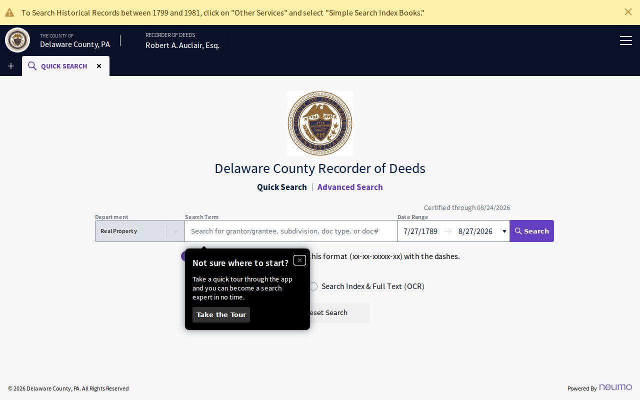
Use the result as an index entry first: note the grantor or grantee role, document type, recording date, document number, and parcel. A deed records an interest transferred. It does not prove that every person at a street address lives there.
The Recorder's legacy Online Services says its land-record indexes and images cover records since 1799. For an early title issue, compare the displayed system coverage with the Recorder or archival route rather than assuming every older record has the same online image access.
Delaware County Street Records by Address
Address-keyed sources answer different questions. The street directory value comes from keeping the sources separate, then comparing the stable identifiers they share. A Recorder document can be tied to a parcel or legal description. A municipal permit file is held by the local government. A historic map can show a lot or building footprint, but it cannot name a full household.
| Address record | Delaware County keeper and channel | What it can establish | Important boundary |
|---|---|---|---|
| Parcel and tax record | Property system and Treasurer | Owner, building, folio/map, and tax context | An owner is not a household roster. |
| Recorded deed or instrument | Cloud Search, Online Services, or Recorder counter | Recorded parties, date, document number, parcel, and legal description | A party may not be a current occupant. |
| Map and zoning context | County Planning and the local municipality | Parcel geography, zoning orientation, and the proper local office | Current permit and code detail stays with the municipality. |
| Historic assessment | Delaware County Archives | Assessment trail from 1791 into 1903 | Coverage and boundaries change over time. |
| Historic map or atlas | County historic-map holdings | Street layout, lots, and building context | A map does not identify all residents. |
| Regulated voter product | Election-authorized request route | Specified election-record fields when law permits | Use and republication limits apply. |
The Register of Wills and the Archives can also be useful for an estate or historic administration trail, but an index hit may require a permitted copy request or counter visit. Treat that as a documented lead, not a shortcut to a current address.
Map Delaware County Street Parcels Carefully
The county parcel-map application supplies Parcel-ID lookup plus point, box, polygon, line, freehand, and buffer selections. Identify and Selection Manager controls help show what was selected. Start with the subject parcel, narrow the selection, and record the map date and method. A buffer and a touching-polygon selection are not the same geographic claim.
After the map identifies an address, use the municipal directory before asking about permits, inspections, or local street files. Delaware County has 49 municipalities, and County Planning says a municipality holds the current zoning map and ordinance material. The county map is useful for orientation; it does not replace the clerk, code office, or open-records officer for the confirmed borough, township, or Chester address.
Historic Delaware County Street Listings
For an older street listing, County Planning describes an address-keyword method through Ancestry city directories: leave the name fields blank, set the place to Delaware County, Pennsylvania, and use the house number and street as a keyword. Read every hit with its year, title, page, abbreviations, and community scope. That makes a directory a dated observation rather than an unsupported chain of residents.
The Delaware County city directory material explains the local directory collections in depth. For a street search, pair a directory year with a released census image, newspaper notice, or original map only when the dates fit the question. Delaware County Libraries and the Delaware County Historical Society are practical routes for this kind of historical check, while the property and Recorder systems handle the modern parcel trail.
County map holdings include atlases from 1870 and 1875, a 1902 Baist atlas, 1909 and 1913 Mueller atlases, 1920s Sanborn updates, later mapping, and Chester Sanborn volumes. Compare a historic street label and lot pattern with the legal description instead of assuming a modern house number existed in the earlier source.
Early Delaware County Street Records
Delaware County separated from Chester County in 1789. That split matters when a deed, road, map, or family record seems to disappear before the county's formation. The Pennsylvania State Archives guide starts Delaware County deed books with Volume A for 1789 to 1793, while the Recorder's legacy online statement begins its land-record image and index coverage at 1799. Early work may need the Recorder, the State Archives, and a Chester County context check.
The same care applies when municipal boundaries change. The county's historic-research material warns that municipal divisions evolved and points researchers to a municipal genealogy chart. When a street result does not match its current address, try the historic municipality, a cross street, lot or subdivision, the legal description, and a prior recorded party. No countywide, year-specific street-renumbering rule was verified, so a universal renumbering date should not be assumed.
Note: A parcel match can be precise today while a historic address still requires an atlas or original deed to establish continuity.
Delaware County Street Directory Terms
These terms make an address search easier to audit. They also help prevent a parcel result from being read as more than it says.
- Parcel
- A county-defined unit of land tracked in the property system with identifiers such as a Parcel ID or TaxMap ID.
- Situs address
- The physical location of the land in a parcel record. It can differ from a tax correspondence address.
- Legal description
- The land identity carried in a deed, often using a lot, block, subdivision, or metes-and-bounds description.
- Criss-cross directory
- A directory arrangement that helps connect an address to a listed person for the publication year, subject to the volume's scope and gaps.
Delaware County Street Copy Choices
The Recorder public-access page identifies two official online systems, the free Property Alert service, and the counter route at Government Center, Room 108, 201 W. Front Street, Media. The Recorder lists counter hours of 8:30 a.m. to 4:30 p.m., with recording hours ending at 3:30 p.m., and telephone 610-891-4152. Copies can come through either online system or the counter; Cloud Search is the route specifically identified for electronically certified copies.
The Recorder access page shows the two official search routes and the Property Alert option tied to a property ID.
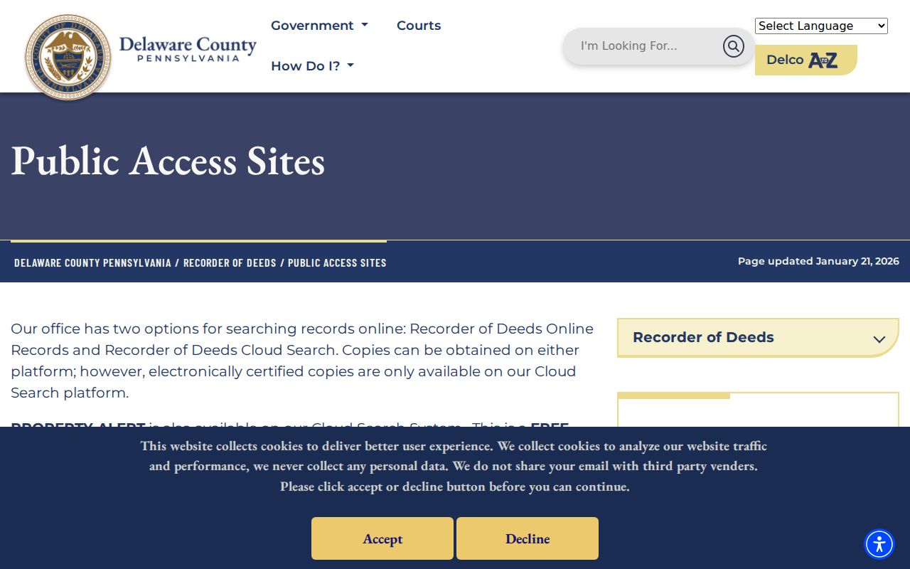
Property Alert is a free notice that a document was recorded against a parcel ID. It is a prompt to inspect the document with the Recorder, not proof of a fraudulent transfer or a substitute for a title decision. Check a live fee schedule before ordering: the Cloud configuration inspected for this research displayed a per-page charge and copy charge, and its published schedule listed electronically certified Cloud Search copies at $12.50 effective December 1, 2025.
Delaware County Street Directory Privacy Limits
A street directory can document parcels, recorded parties, and dated historical listings. It cannot reliably identify every person in a home. Unlisted household members, utility and delivery data, motor-vehicle information, sealed court material, and protected addresses are outside this street search. Pennsylvania's Address Confidentiality Program can provide eligible participants a substitute address for specified government and court records. A no-result is not proof that a person is absent from a street.
Voter information has its own limits. Pennsylvania Election Code provisions at 25 Pa.C.S. §§ 1207 and 1404 regulate inspection and requested voter products, require identification and a signed use statement, and limit improper publication. The public registration-status tool is identity-matched, not a street browser. Ask the proper election office about an authorized purpose instead of treating a property map as a voter list.